Bamford Moor South Stone Circle
Location
Bamford Moor
Derbyshire
OS Grid Reference SK 22105 84530
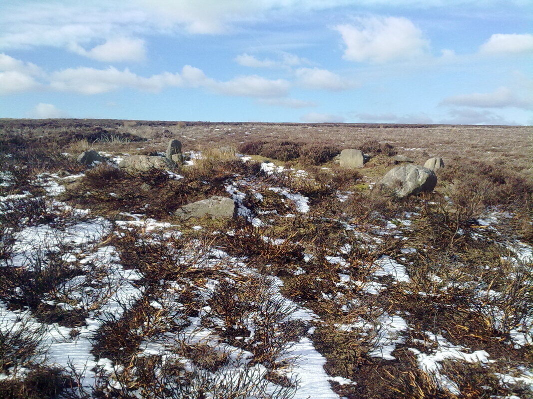
Located on the south of Bamford Moor this circle can be quite tricky to find, though thankfully in this case not due to it's state, being one of the better preserved sites in the area but due to it's location which warrants an off path hike across the moor through heather and boggy ground, a compass or a gps device are recommended
There are a few ways to approach the site but here we'll deal with the easiest route by car.
From the A57 by Ladybower reservoir take the A6103 Bamford till a couple of hundred metres past The Yorkshire Bridge pub where you'll need the first left turn up the narrow New road, follow the road for around 2km staying on it till you reach a junction where you need to turn left and continue till you cross a cattle grid, this is the parking area known as Dennis Knoll which will be your starting point.
Take the track heading towards Stanage edge ( not the paved road) where after a short way you need to take the stile on your left onto the moor, head back along the fence line till your half way back to the parking area, from here you should proceed in a line directly West, or with your back to the fence straight ahead for around .75km which should put you close enough to the circle to spot it.
Bamford Moor
Derbyshire
OS Grid Reference SK 22105 84530
Located on the south of Bamford Moor this circle can be quite tricky to find, though thankfully in this case not due to it's state, being one of the better preserved sites in the area but due to it's location which warrants an off path hike across the moor through heather and boggy ground, a compass or a gps device are recommended
There are a few ways to approach the site but here we'll deal with the easiest route by car.
From the A57 by Ladybower reservoir take the A6103 Bamford till a couple of hundred metres past The Yorkshire Bridge pub where you'll need the first left turn up the narrow New road, follow the road for around 2km staying on it till you reach a junction where you need to turn left and continue till you cross a cattle grid, this is the parking area known as Dennis Knoll which will be your starting point.
Take the track heading towards Stanage edge ( not the paved road) where after a short way you need to take the stile on your left onto the moor, head back along the fence line till your half way back to the parking area, from here you should proceed in a line directly West, or with your back to the fence straight ahead for around .75km which should put you close enough to the circle to spot it.