Bunkers Hill Plantation rock shelter / cave
Location -
Bunkers Hill plantation Beeley moor
Derbyshire
OS Grid Reference - SK 28436 69036
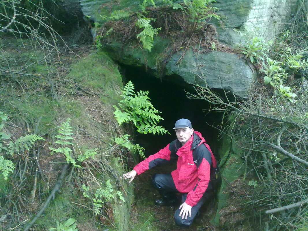
A difficult site to find if you've not been before, i have Stu to thank for leading me there for my first visit, which i'm sure saved me quite a bit of time as the cave is not immediately visible from the track that runs through the plantation.
The cave is on private land owned by the Chatsworth estate and just off the track that leads up besides the plantation to Hob Hursts House.
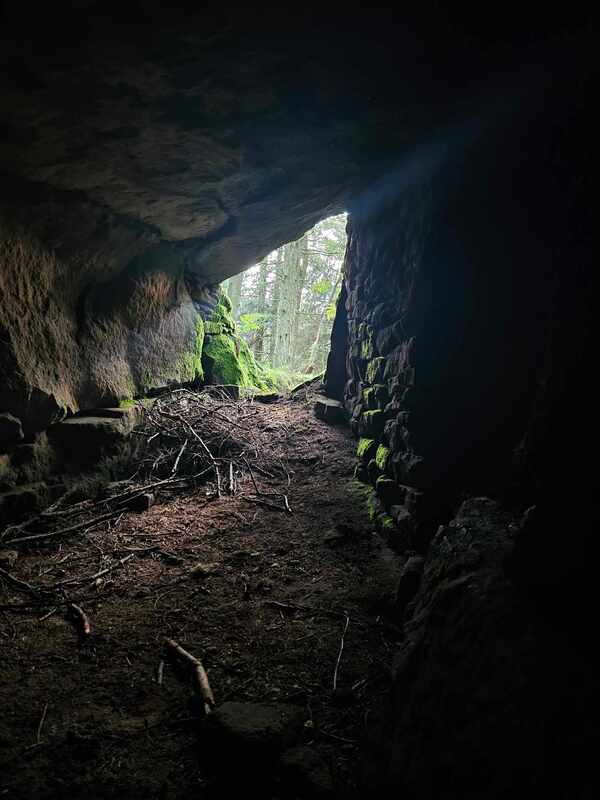
Around 8 metres deep and two metres high, when we visited in persistant rain the interior was quite dry, someone had been there previously and had left their empty lager cans behind, (which we removed) on the whole though the cave is quite clean unlike some others in the area, this is probably due to it being quite difficult to find i imagine.
The north wall of the rock shelter is made up, in the most, of drystone walling. This was reported when the cave was first discovered by a forester in 1957 (the Ordnance Survey inspectors couldn't find the cave in 1959). So the walling is at least over 50years old; but how old is uncertain.
Excavated in 1957 and 1966 when sherds of bronze age collared urns were found, but nothing else.
To find the site you need to travel up through Beeley village and follow the road for around 2km, parking is by the roadside at Hell Bank plantation, as you leave the narrow twisty part of the lane and emerge back out the other side of the trees you'll notice a sharp right hand bend in the road and a track off to the left, walk along the track, which can be very muddy, for around 700 metres till you see the entrance for Beeley moor, there's a large wooden gate and a stone stile / steps, you can take either of the tracks but if you follow the larger track you can incorporate a visit to Parkgate stone circle.
The plantation is easily visible to the north of the access point to the moor.
Note: If your approaching from the Sheffield side take the second entrance to the village and not the signposted one, the first if your approaching from the Matlock side.
Bunkers Hill plantation Beeley moor
Derbyshire
OS Grid Reference - SK 28436 69036
A difficult site to find if you've not been before, i have Stu to thank for leading me there for my first visit, which i'm sure saved me quite a bit of time as the cave is not immediately visible from the track that runs through the plantation.
The cave is on private land owned by the Chatsworth estate and just off the track that leads up besides the plantation to Hob Hursts House.
Around 8 metres deep and two metres high, when we visited in persistant rain the interior was quite dry, someone had been there previously and had left their empty lager cans behind, (which we removed) on the whole though the cave is quite clean unlike some others in the area, this is probably due to it being quite difficult to find i imagine.
The north wall of the rock shelter is made up, in the most, of drystone walling. This was reported when the cave was first discovered by a forester in 1957 (the Ordnance Survey inspectors couldn't find the cave in 1959). So the walling is at least over 50years old; but how old is uncertain.
Excavated in 1957 and 1966 when sherds of bronze age collared urns were found, but nothing else.
To find the site you need to travel up through Beeley village and follow the road for around 2km, parking is by the roadside at Hell Bank plantation, as you leave the narrow twisty part of the lane and emerge back out the other side of the trees you'll notice a sharp right hand bend in the road and a track off to the left, walk along the track, which can be very muddy, for around 700 metres till you see the entrance for Beeley moor, there's a large wooden gate and a stone stile / steps, you can take either of the tracks but if you follow the larger track you can incorporate a visit to Parkgate stone circle.
The plantation is easily visible to the north of the access point to the moor.
Note: If your approaching from the Sheffield side take the second entrance to the village and not the signposted one, the first if your approaching from the Matlock side.